
Auckland Arrival
Thu, Feb 16
It was raining moderately hard when our Air Tahiti Nui A340 touched down in Auckland. Travel on Air Tahiti Nui was as pleasant as our previous experience on Air New Zealand except all announcements were first made in French, then in English, so those who understood French got first dibs on emergency info. The nice people at Apex Rental handed me the key to a tired old Nissan Note, circa 2004, and off we went. On the left side of the road. Yikes. Calling up learned motor skills from our last NZ trip in 2015, things smoothed out on our way to Ponsonby, Auckland’s trendiest little neighborhood with lots of shops, bars, restaurants, etc. We lucked out in finding on-street parking in front of our Ponsonby Airbnb, “The Cabana”.
North to Mangawhai Heads and Whangarei
Fri, Feb 17
Rain tapering off. Walked over to a nearby coffee shop for our morning flat whites and popped into a Vodaphone store on the way back to The Cabana to pickup a local NZ SIM card for my phone. Jason, our Airbnb host, invited us into the main house for a second coffee. He’s a leading real estate agent, a pastry chef, a world traveler, etc. An interesting fella.
The last time we were in Auckland, we had wanted to tour the New Zealand Maritime Museum but arrived too close to closing so this time we grabbed a morning bus to the Central Business District (CBD) and spent as much time as we wanted in the museum. If one country has a deep maritime history, it's New Zealand, and the museum thoroughly satisfied our interests.
 |
| NZL32 won the 1995 Americas Cup in San Diego |
An hour later, we arrived at Mangawhai Heads on the east coast. Sun was breaking out over the water though dark clouds were building inland. We strolled along the empty beach with vistas to distant islands, like Hen and Chicken Island, and began the climb up the Mangawhai Cliffs Walkway but turned back after 15 minutes when it started to sprinkle. Since it was late in the afternoon and we wanted to get to our Whangarei Airbnb before dinner time, turning back got a big thumbs up.
 |
| Hen and Chicken Island from Mangawhai Head |
Bream Head and North to Paihia
Sat, Feb 18
Weather continued to improve. Returning to the eastern coast, we started climbing the Bream Head Loop Track in bright sunshine but when we reached the WWII radar site (about a 1200’ ascent), we had penetrated the low cloud layer and lost visibility. Climbing is all (well mostly) about vistas so we returned to the carpark.
 |
| Bream Head Loop Track |
Then we drove to the AH Reed Kauri Park for a stroll through the forest canopy on an elevated walkway, not exactly way up high in the canopy but still plenty high above the wet, fragile forest floor. The walkway wraps around the giant trunks of Kauri trees, allowing a close and personal touch. We walked to nearby Pukenui Falls (79’) and then the larger and more popular Whangarei Falls (86’).
 |
| Kauri Canopy Walk in AH Reed Park |
 |
| Saltwater Lodge |
Wandering around town, we kept seeing the Chevy V8-powered Thunder-Trike cruising up and down the main drag with grinning customers who laughed each time he goosed the throttle. We were lucky to get a table at Rayz on the Bay where we found nice craft beer, food, and people watching.
Bay of Islands
Sun, Feb 19
Gorgeous sunny day, perfect for biking around Paihia on our orange Saltwater Lodge beach bikes. We ferried them across the bay to Russell and rode every single road we could find, some very steep with one requiring walking.
 |
| Orange bikes stealing the fashion show. |
 |
| Giant crayfish in the Russell Museum |
 |
| Russell and the Bay of Islands |
 |
| Sue went for a swim in Oneroa Bay on the backside of the Russell peninsula. |
The Kohukohu Pub bartender looked up when we entered and gave us the deer-in-headlight look for a few seconds before regaining composure. Apparently they don’t get very many tourists. The kitchen had closed a half-hour prior but he dragged a reluctant server out for an awkward and uncomfortable discussion on what what kind of food was available. Fish and chips, and beer, made for a decent outcome.
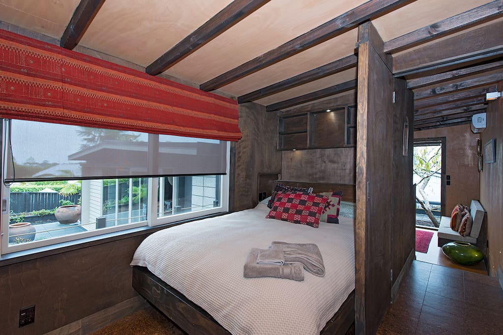
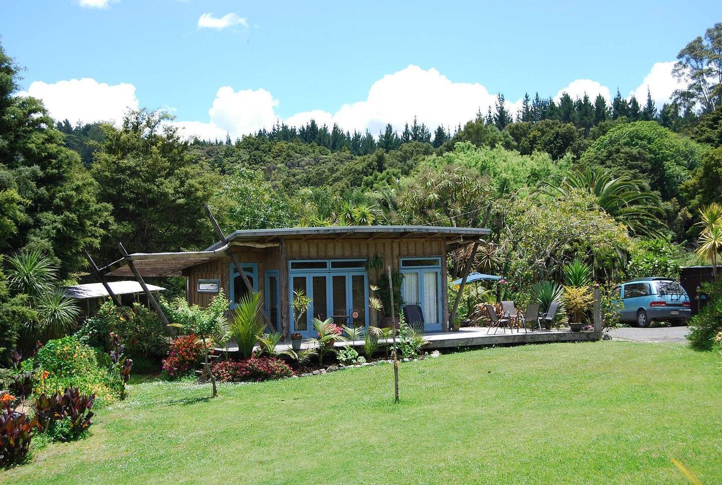 A few minutes down the road, our next Airbnb, the “Nature Retreat”, could be found at the bottom of a steep gravel driveway where our car bottomed out a few times on protruding boulders and drainage ditches. We found a compound with several small buildings, an old school bus, an old RV camp trailer, clotheslines sagging with sheets, an open grassy center surrounded by tall brush and trees laced with grassy paths and natural gardens. We were met by a young friendly American woman who was one of two WWOOFers helping out the host, Angela. While our room was private in one of the separate buildings, it featured ventilation through big open screenless glass doors, flying bugs, a private bathroom accessed via a dark outdoor walk on a covered deck, and a composting toilet. In keeping with the retreat setting, wifi was only available in a common space inside the main building. Our stay was comfortable, only a little bit challenging, and provided an interesting experience consistent with offbeat traveling.
Hokianga Harbor and South Along the West Coast to Te Kauwhata
Mon, Feb 20
We got a very early start so that we could catch the first ferry across Hokianga Harbor to Rawene. Another gorgeous day, slightly misty in the low moist areas, beautiful sunrise over the eastern hills across the harbor while on the ferry.
 |
| Ferrying across Hokianga Harbor |
Drove south along the west coast and stopped in the Waipoua Kauri Forest to visit New Zealand’s largest Kauri tree, Tane Mahuta. Impressive, with great girth, but not a lot of height, though perhaps unfairly I had Giant Sequoias in mind.
 |
| Tokatoka Peak |
South of Dargaville, we parked to climb Tokatoka Peak, a conical volcanic core rising from the coastal plains. The climb (~500’, 20 minutes) is a steep climb up a dirt lower, rocky mid, and sheer rock upper section. Great view from the top.
Drove south towards Auckland on Route 1 and, again, encountered the choice of toll or toll-free. This time, I chose toll-free and exited the motorway onto the attractively named Hibiscus Coast Highway which eventually looped its way back to Route 1 but became very scenic as it dropped down to the beaches of Hatfield and Orewa. Back on Route 1, we sped through Auckland and continued south towards our Te Kauwhata Airbnb.
 |
| Waikato Museum in Hamilton |
 |
| Country cottage Airbnb in Te Kauwhata |
Afterward, we headed back north to a fabulous Airbnb, our favorite yet. Setting was rural suburban highlands with an expansive view of the hills rising above distant Lake Waikare. The apartment was spacious, bright, clean, well-stocked with food and drink, and sported a washing machine that we took advantage of. We were met by one of the two retired service dogs on site, a big lovable yellow lab. The hosts, Jan and John, were super accommodating with lax checkin and checkout times.
Raglan to Otorohanga
Tues, Feb 21
Gorgeous day. Drove an hour south to Raglan, a hippy surf town on the west coast. Found the best coffee in New Zealand, at Raglan Roast.
 |
| Bovine spectators on the loose |
 |
| The Tasman Sea from the Te Toto Gorge |
 |
| Bridal Veil Falls |
We headed back inland to Otorohanga for our next Airbnb, the “Farm Cottage in Waitomo Valley”, where the host, Sarah, was remote so we were all alone in an entire house way out in a quiet agricultural valley. Horses watched us unload the car from across the street. We noticed after dinner the Milky Way appeared brightly with Orion’s Belt right above us, yet we thought you couldn’t see northern hemisphere constellations in the southern hemisphere so we decided we’d research this oddity later (of course we forgot to).
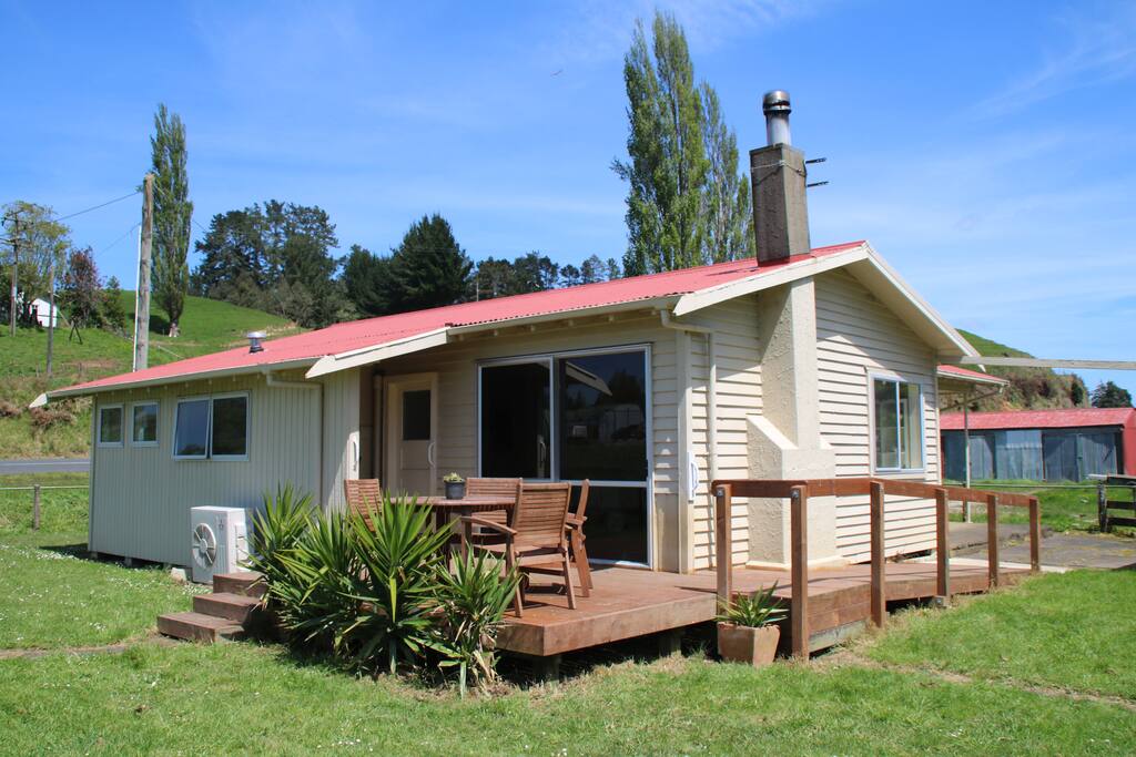 |
| Farm Cottage in Waitomo Valley |
Waitomo Caves and West Coast Beaches to New Plymouth
Wed, Feb 22
Another gorgeous day. Sarah drove up and intercepted us in the driveway as we were backing out. She had a strange accent, part Kiwi, part Chicagoan, a result of 10 years in New Zealand. We always enjoyed meeting our hosts when possible.

Driving through Waitomo, which boasts one of New Zealand’s biggest tourist traps, the Waitomo Glow Worm Caves (imagine billboards, parking lots, buses, and souvenir shops), we didn’t even slow down. But once the neon faded, we stumbled upon the Aranui Caves and explored tiny caves and waterways carved through the limestone, accessed along easy paths. And a short drive further led us to the Mangapohue Natural Bridge which had a short walk to a stunning limestone double archway.
 |
| Creature emerging from Aranui Caves |
 |
| Double archway in the Mangapohue Natural Bridge |
 |
| Marokopa Falls |
 |
| 1937 Chrysler parked at tunnel access to beach. Owner (an American from NC, now living in NZ) had purchased it in Auckland 4 days prior. |
 |
| Waikawau Tunnel Beach |
 |
| Alien forms on Waikawau Tunnel Beach |
Back on the road to New Plymouth, we stopped at the beaches in Tongaporutu where we found the blackest sand we’d ever seen and giant standing rocks and arches, many named like 3 Sisters and Elephant Rock. We were able to walk through one of the arches before being chased away by the rising tide.
 |
| Walking towards 3 Sisters |
 |
| Low tide photo op |
 |
| Tongaporutu boulders, reminiscent of the Moeraki Boulders on the South Island, came in different sizes |
 |
| Kids self-learning to surf |
 |
| Nick and the nice guys. And a chicken. |
 |
| View of Mt Taranaki from our Airbnb |
Mt. Taranaki
Thu, Feb 23

 |
| Last chance for a toilet |
The morning sun was bright and warm and the fleeces came off before we reached this point. The only flora at this elevation were low shrubs and ground sprigs. Next were some rock scrambles and wooden staircases to get up a steep field of loose jagged rock and delicate flora. Nick said one of his recent clients counted 432 stair steps. We didn’t count but that seemed about right. No further vegetation could be seen other than little patches of lichen and an occasional mini-flower.
This put us onto a long steep frustrating scree field that rewarded each step with an unpredictable half-step backward. Slow going as we searched for traction. Dozens of climbers were on this pitch, with differing paces governed by experience, luck, and tread design. Some were on all fours at times.
 |
| Scree! |
After this was a long climb on a rocky spine called the “Lizard”. The Lizard was fun for those with some rock climbing experience since hand and foot holds were all over the place. Colored posts installed all the way through the scree field and Lizard guided hikers during low visibility but on this day, our line up the Lizard was whatever we wanted. The Lizard peaked at a false summit, the crater rim.
 |
| Flora on the Lizard |
Crossing the snow-filled crater to reach the final pitch of loose lava rock was tricky as the steep edges on each side were icy and more slippery than the scree field.
 |
| Having fun in the crater |
 |
| Summit selfie |
 |
| Summit stroll |
 |
| Lunching while watching some of the ants on the snow |
After an hour of lunching and exploring, we began our descent. We were tired and found the descent to be more difficult than expected, especially where the surface was loose. Sue and I both fell a few times with bloody hands and arms to show for it.
 |
| Descending the Lizard |
 |
| Nursing wounds with good craft beer |
New Plymouth and Ameri-CAR-na
Fri, Feb 24
Nick’s response to our Taranaki story was “Good on ya!”, Kiwi for, “nice job!” It was a rest day for us so we toured around New Plymouth, which turned out to be a wonderful little city. The weather was once again perfect so we rented bikes to explore the New Plymouth Coastal Walkway, an 8 mile long, award-winning piece of civil and social engineering brilliance.
 |
| Coastal Walkway's grassy parts |
 | |
|
 | |
|
 |
| The Te Rewa Rewa Bridge frames the cloud-veiled Mt Taranaki in the distance |
 |
| Len Lye Centre |
 |
| Giant pieces of stainless steel spinning, whipping, slamming, twisting. For scale, note the earmuffed people in lower right of photo. |
When we first arrived in New Plymouth, we noticed American flags flying all around the city. Our dinner server at Frederics told us it was the annual Ameri-CAR-na Festival that week. Kiwis LOVE big, bold, and brash American cars and this was a celebration of vintage, classic, muscle, and anything-goes American car stuff. Friday afternoon featured a big car parade down the street next to our Airbnb that led to a giant car show downtown where the roads in the CBD were closed so that the 800 registered cars could park and be fondled by 1000s of fans. We watched the early part of the parade, which was loosely formed and sprinkled with other vehicles, like commuters, tourists in rental cars, and tradespeople in work vans. Rowdy crowds in good spirits heckled the interlopers.
 |
| American iron with Mt Taranaki as a backdrop |
 |
| Cape Egmont Lighthouse |
On the drive back to New Plymouth, we stopped in Oakura for dinner at Butlers Reef bar & Grill. Beer good, food good, service not so good; we figured the staff was tired after a busy Friday night.
Forgotten World Highway to Raetihi
Sat, Feb 25
 A beautiful morning. Before checking out of Nick’s house, we asked for a tour of his garden. Imagine a neatly manicured neighborhood with out of sight cars, implements, people, etc. Nick’s 6’ high privacy fence barely disguised the free and natural wildness happening behind it. He practices permaculture and has established over the last three years active and sustainable systems for growing and maintaining a significant number of fruit and vegetable plants, and even a small flock of chickens. Neighbors have been won over slowly through gifts of food, one zuchini at a time.
We drove the Forgotten World Highway which snakes 93 miles from Stratford to Taumarunui with zero civilization along it except for the decaying settlement of Whangamomona at the halfway point, where we stretched our legs and absorbed the desolation and sadness of this once prosperous township.
 |
| Whangamomona Post Office closed for business |
 |
| At least there was some color in Whangamomona |
When we arrived in Raetihi later in the afternoon, we found another town that had seen better days. Once a thriving railway town serving a booming timber industry, it had gone through depressive cycles and is trying to regrow with the recreation economy. We found many closed shops, though one, The Barbed Wire Gallery looked to be bright and cheerful.
 |
| Cheerful living room in our Airbnb |
This was our Airbnb for a couple of nights, specifically the large apartment attached to the back. The gallery didn’t have regular operating hours but the owner left a note inviting us to explore the gallery whenever we wanted and to just leave a payment for anything we wanted to buy. As pseudo-minimalists, we were more interested in looking than buying, though I did wind up purchasing a Barbed Wire greeting card. We made dinner in the well-stocked kitchen and got to bed early in preparation for tomorrow’s big adventure!
(The World Famous) Tongariro Alpine Crossing -
Hybrid Edition
Sun, Feb 26
The other big hike we hoped to complete on this trip was the Tongariro Alpine Crossing (TAC), described as one of the best one-day hikes in New Zealand, if not the world. It’s a 12 mile 5-8 hr one-way hike and ascends 2500’ before dropping 3700’. Tongariro National Park is a dual World Heritage area, recognized for its outstanding natural features and cultural significance. The typical hiker arranges an end-of-hike shuttle ride back to their car or lodge. This is one of New Zealand’s most popular hikes with hundreds of people starting from the same point around the same time each day.
We had discussed our goal with Nick before leaving New Plymouth and he was eager to suggest a “better” idea, which was to start the TAC with everyone else but to turn off near the 1 mile mark onto a goat path that ascends to a ridge line along the backside of Mount Tongariro where, after summiting, you reconnect with the other hikers and return to the carpark on the TAC, but in the reverse direction and after most of the morning hikers have passed through. This strategy delivered 3 benefits: you avoid the mad crush of hikers for most of the hike, you still experience the most spectacular parts of the crossing near Red Crater summit, and you don’t have to deal with a return shuttle since you’re hiking a loop back to your car. We were sold!
 |
| Cables were available if needed |
Three hours in, about midway where the TAC reaches it’s highest point near Red Crater, our minds were reeling from the beauty. Every direction offered magnificence. Icy Blue Lake on one ridge line, steamy brilliant green water in Emerald Lakes, the imposing volcanic cone of Mt Ngauruhoe (Mt Doom in the LOTR movies) above us, deep gashes and lava vents protruding from craters, deep blue sky overhead and a sea of white clouds below.
 |
| View from Red Crater summit of Blue Lake and Emerald Lakes |
 |
| Volcanic vent feature |
We split from the TAC and climbed to the summit of Mt Tongariro where we found a handful of other hikers who then returned back to the TAC after enjoying the peaceful views away from everyone else. We lunched under Doom’s gaze.
 |
| Sign pointed the way for us |
 |
| Lunching eye to eye with Mt. Ngauruhoe (Mt. Doom) |
Low clouds were forming and wafting up Tongariro’s backside, urging us to get going in case the weather turned heavy quickly. Nick had told us to search for cairns to find our way along the backside. We began our descent and immediately found the going confusing as there was no path, no one in sight, no cairns, nothing but scree, boulders, and mist.
 |
| More scree action |
We adopted a serpentine search pattern, similar to training I’ve had for searching for snow avalanche victims, looking for traces of boot marks, all the while avoiding stepping on fragile flora (mostly lichens but small flowers were becoming more prevalent). We were occasionally able to pick up and follow a faint trail before losing it again.
 |
| What is the proper cairn etiquette? Add, Delete, or Save? |
A dry waterfall bed that angled steeply down instead of a sheer drop looked like the best bet so we carefully picked our way down, rock by rock, careful again to not step on vegetation, which was more abundant than higher up. By the time we reached bottom, which was well below the level of the TAC track and about a 1000’ feet away, the vegetation had thickened significantly to the point where it was difficult to see the ground through large puffs of grassy fronds and viciously tangled brush that had to be forced or broken to take a step. Visibility beyond the next obstacle was rare. We also faced water crossings up to 4’ deep and a couple of hundred feet of wetlands riddled with hidden water channels.
Things looked impassable and feelings of desperation clawed at us. Our choices were to backtrack all the way for hours with a return in the dark or commit to finding a way across the forbidden zone, and hope we didn’t get arrested for destroying native plants. Lousy choices. I hated the bushwhacking one less, and since the situation felt dire, Sue was agreeable with my choice.
We forced our way across the wetlands, but instead of trying to step between the grassy sedge cushions, we were stepping right in the center of them if we could see them. Once, a foot slurped its way past a tuft edge and my boot instantly filled with water and muck. Luckily, we were able to find narrow gaps where we could jump across the streams. I could hear Sue verbally squirming as she tried to avoid icky things. "I'm way outside my comfort zone", she muttered. Each step required pushing tall brush aside, sometimes accompanied with a snap or two. I kept describing what I was doing and what I could see as a feeble, yet effective, attempt to help calm her and suppress her urge to panic. I didn't mention all the spider webs I destroyed until later (she thanked me for that). We eventually reached the far side of the wet valley floor where we found the bank to be vertical for about 20’. This necessitated graceless jungle gym moves to clamber up and through incredibly thick brush. The slope slowly gave way to gentler grades and brush, and finally, after an hour (total) of struggling, we rejoined the TAC track.
Looking both ways, nobody was in sight, whew, and we were back in the carpark by 4pm. We surveyed the damage: Sue had bloody gashes on her bare shins while I merely had the wet pant leg. Two young french guys enjoying their gap year accosted us near our car and asked for a ride back to the main road. Made me wish I had taken a gap year in New Zealand. In 1976. To nurse our new wounds and celebrate our survival, we splurged on an elegant dinner at the posh Powderkeg Restaurant in Ohakune.
Taupo
Mon, Feb 27
Another gorgeous day. We drove an hour north to Lake Taupo, New Zealand’s largest lake, which is situated in the Taupo Volcanic Zone along with the other major geothermic features on the North Island, such as White Island and the volcanoes in Tongariro National Park.
At the south end of the lake, we took a quick tour of the Tokaanu Thermal Walkway, which proved to be a disappointment. Very little in the way of thermal gurgling or spewing to see or hear, though there was some steam to prove there was something hot in the area. At least it was a free tour.
During the 45 minute coastal drive north to the touristy city of Taupo, we enjoyed the expansive views across the lake. The slower pace of the lake traffic was a nice contrast to the frenzied mountain driving favored by locals in other parts of the country.
 |
| Lake Taupo is NZ's largest lake |
 |
| Huka Falls. Note scale of the people in the upper left. |
Across the street, “The Craters of the Moon” is another free-admission geothermally active park where you get what you pay for. Better than Tokaanu, but not by much.
Downstream from Huka Falls, the Waikato River is choked off by the Aratiatia Dam that feeds the Aratiatia Power Station. Excess water is released through spill gates, creating temporary rapids for tourists to see 4 times per day. While waiting on an upper observation deck for the 2pm opening, we noticed teenagers goofing around on the rocks below. 2pm came and went with no release. Then we heard dam safety personnel yelling at the kids to get off the rocks. There had been a death two weeks prior under similar circumstances and the dam was not taking unnecessary chances.
 |
| View of Acacia Bay from our Airbnb |
Near dinner time, our research revealed the best place in town for craft beer was the Lakehouse, where we also found excellent food, and a nice view of the lake. Returning late to our Airbnb, we noted dark clouds in the distance and enjoyed a dramatic lightning storm over the lake that night.
Kayaking Lake Taupo
Tue, Feb 28
Looking like a clear day was in store, we rented kayaks from the nice people at Taupo Kayaking Adventures. The big lake draw for tourists is a large Maori rock carving on Mine Bay, which was 2 hours by kayak from Acacia Bay. The 46’ high carvings were completed in 1980 by Maori artists. During our slog into the wind, we saw heavily loaded two-masted sailboats, big party cruisers, and even a helicopter heading for the carving. We imagined crowds blocking the view and souring our experience, but by the time we arrived, they had all left which made it easy for us to linger and enjoy our solitude with the massive work. Our return paddle was a little faster with the wind, but our arms were weaker making for an exhausting day. We made a rare encore restaurant visit that evening, to the Lakehouse. Best craft beer of the trip.
 |
| Paddling into the wind |
 |
| Sue getting a close look at the Maori rock carving in Mine Bay, Lake Taupo |
Wai-O-Tapu Stinky Wonderland
Wed, Mar 1
A beaut of a day. We thought we’d give the Aratiatia Rapids another try on our way out of Taupo so we hiked in to the mid-level viewing platform, 100’ above the canyon floor, for the 10am water release. The warning sirens blew, followed by a slow motion transformation of a quiet babbling brook into a roaring full-fury white water death flow. The excitement lasted 20 minutes before fading back to a low gurgle. Peter Jackson filmed the hobbit barrel escape scene from The Hobbit - The Desolation of Smaug using two of these water release events.
 |
| Aratiatia Rapids - before and after water release |
Thirty minutes north of the rapids, on the Thermal Explorer Highway, was Wai-O-Tapu Thermal Wonderland, a very popular park and one of very few where we were willing to pay the admission fee. Featuring a variety of steamy, colorful, and stinky pools to wander around, the neon green pool with high concentrations of sulphur compounds was especially vivid.
 |
| Champagne Pool's orange sides are from arsenic and antimony sulphur compounds |
 |
| Devils Bath's neon green color comes from a high concentration of sulphur |
We had dinner at Hayes Common, a local spot in a quiet Hamilton neighborhood where we enjoyed tasty food and craft beer. Have we mentioned how important good craft beer was to us? We then drove 45 minutes north to our favorite Airbnb in Te Kauwhata, where we had stayed 9 days prior.
e noho rā (Farewell)
Thu, Mar 2
Our last day. Beautiful weather once again. Nothing on the itinerary other than our 5pm departure out of Auckland. We packed our bags in a leisurely way, had our last breakfast, and checked out of our fave Airbnb.
We had a few hours to kill so I finally took the opportunity to visit Bunnings, one of the big home centers in NZ, akin to Home Depot. I’d always wanted to check one out but could never justify the diversion amidst the natural wonders competing for our time. So, I raced through a giant Auckland Bunnings and found that it was very similar to Home Depot (or Lowes) except everything was completely different. Lumber was metric, electrical and plumbing component design were alien, tools and hardware were vaguely familiar but not really, and the store was bigger and had more choices in all kinds of categories than the American stores. I was glad I didn’t have to make any decisions in there.
With our remaining time, we drove up to Maraetai Beach where we enjoyed crystal clear water and views of Waiheke Island, and we played with shells on the sand. Sue waded into the water a final time. For now.
 |
| Final beach walk, on Maraetai Beach |
Excellent read! Thanks for the jog to my memory. Let's go back for a visit soon. No--let's move there.
ReplyDeleteRead every word and did NOT fall asleep. Stunning photos and great descriptions. Glad to know I'm not the only one who writes detailed descriptions of our travels. Katja
ReplyDeleteSeems we were on walkabout at the same time. Your pictures are better!!
ReplyDelete